Since laser scanning offers extensive integration capabilities for most 3D modeling programs, Coast 2 Coast delivers a ready-to-use format and the design team gets a huge head start on the project. Using up-to-date documentation that is within 1/2″ accuracy helps renovation teams plan better and faster.
+1 423 316 1414

Laser Scan to 3D Model: How it Works
1. Laser Scanning Digitizes Buildings FAST
A single laser scanner has the power to survey thousands of square feet per day.
When activated, a laser bounces off the scanner’s rotating mirror onto target surfaces and reflects back to the scanner, creating a mass of dots for each laser-to-surface contact point.
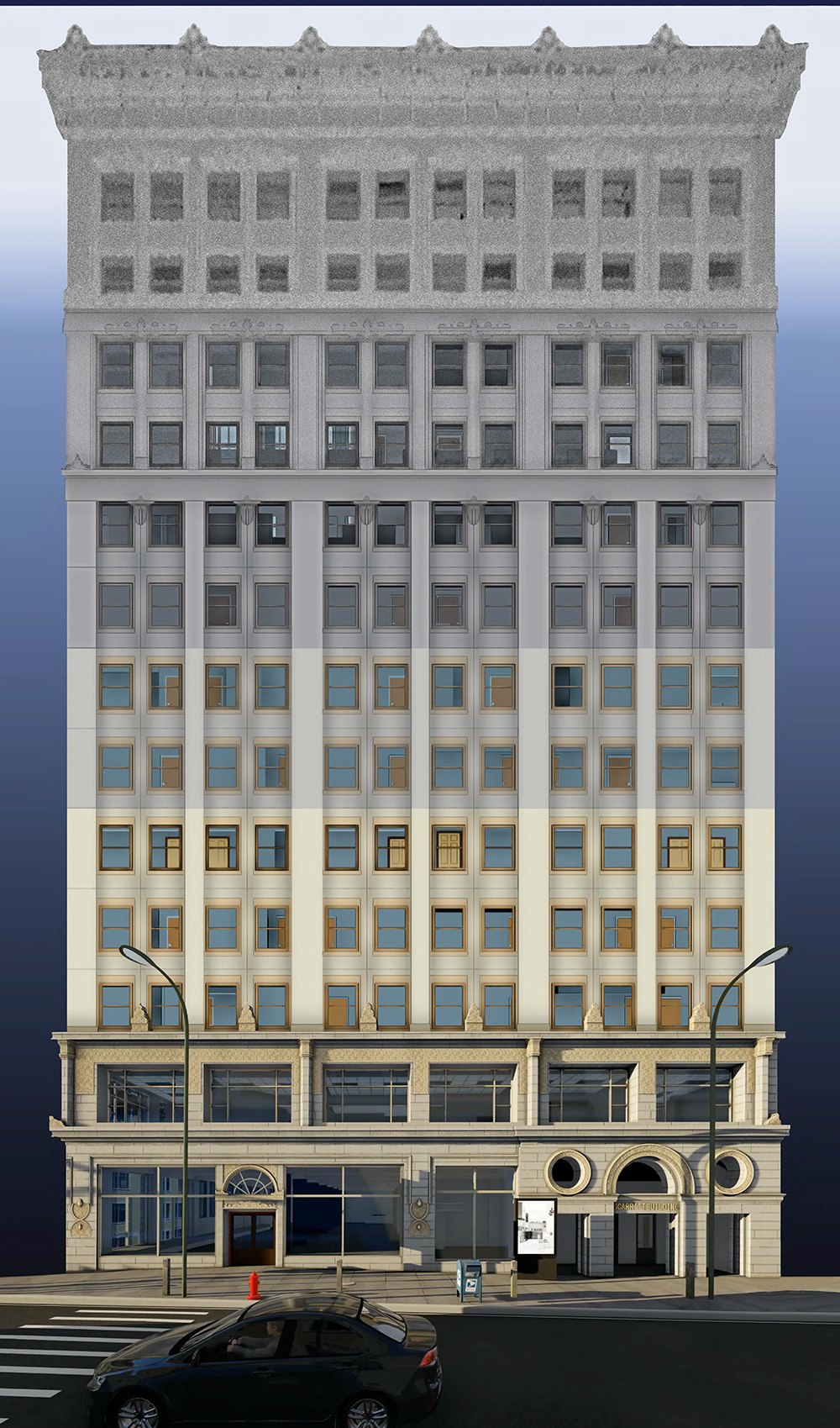
2. The Result is a Photo-Realistic POINT CLOUD Image
The captured dimensional data transforms into a photorealistic point cloud. Each of these data points creates a “cloud” image. These dimensions supply the measurements for geometry. Teams often use the point cloud itself to begin visualization.
3. An Accurate Representation is Created as a 3D MODEL
This cloud of precise measurements is then used to create a 3D Model. Based on the client’s software of choice, (i.e. AutoCAD, Revit, etc.) Curves and planes extracted from the surface create true 3D models. Other specified scope elements from the point cloud are also used to create an accurate representation of the interior objects (walls, windows, doors, elevation changes, electrical finish, pipes, lighting, and much more).
4. RENDERINGS Bring the Project to Life
3D rendering is the process of digitally creating or recreating a location or scene either as an image or animation. Architects, builders, marketers, and other professionals often use 3D renders to explore a wide variety of options without having to invest in travel, props, furniture, photographers, and interior designers.